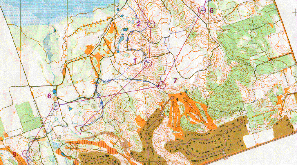
Copeland Forest, Horseshoe Valley, Ontario, Canada
This map was used for Days 5 and 6 of the 1994 Great Lakes Orienteering
Festival, which were also the North American Orienteering Championships.
This particular map was for Day 6, which was one of my slower days of the
event. I was in M21B.
The area is part of Horseshoe Valley Resort, which has fantastic cross
country ski trails, downhill ski hills, and golf courses. The open areas
marked out-of-bounds are the golf courses.

- Scale: 1:15000
- Contours: 5m
- Photogrammetry: Havery Map Services
- Field work : Mark Adams
- Cartography : Mark Adams
- Copyright: Hamilton King's Forest OC
- Map No. : 94-CO-03
This map was prepared for the Great Lakes Orienteering Festival, August 13-21
1994. Possession of this map does not imply free access to the area.
Permission to use this area must be obtained from the landowners through the
Hamilton King's Forest Orienteering Club. HKF thanks the landowners for
their kind assistance with the production of this map. For copies of this
map or for information on orienteering activities, clubs, membership and
teaching materials, contact Orienteering Ontario, 1220 Sheppard Ave. East,
Willowdale Ontario, M2K 2X1; (416)495-4160
Paul Tomblin / ptomblin+website@xcski.com

